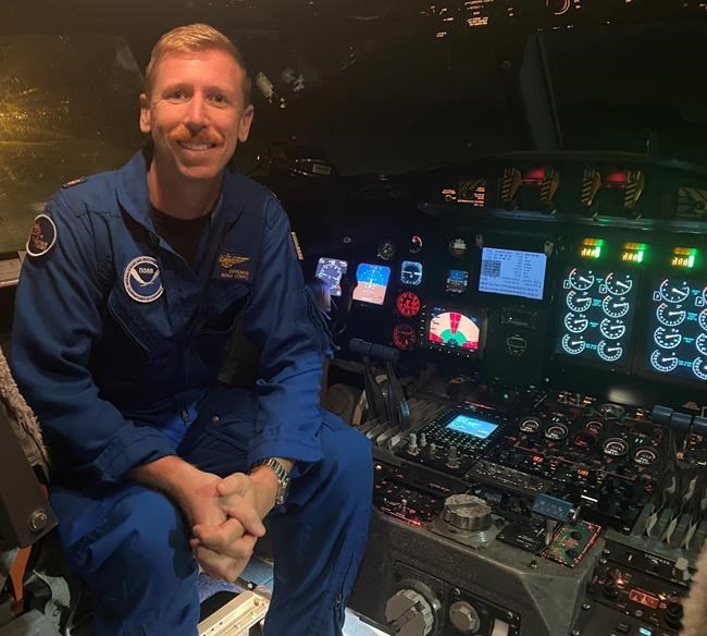
FREDERICTON — Kevin Doremus says the eyes of hurricanes, including Fiona — a storm that barrelled into Atlantic Canada last month causing widespread damage — look like open-air domes, similar to sports arenas.
Doremus, a lieutenant-commander with the United States' National Oceanic and Atmospheric Administration, got up close to the Category 3 hurricane over the Atlantic Ocean as it flirted with the coasts of Aruba and Puerto Rico — days before it was downgraded into a post-tropical storm and made landfall in Canada.
The pilot — known as a hurricane hunter — flies scientists through the eyes of dangerous storms to collect data, using a plane that he affectionately calls Miss Piggy. He said Fiona's eye was presenting what's known as the "stadium effect."
"You basically go through the strongest winds of the storm right through the eye wall and then the winds go from very, very strong to zero very, very quickly," Doremus said in a recent interview. "You go from flying through basically a bathtub — just a ton of rain, a ton of precipitation where you can't see anything out of the window, and then you just break out into the middle of the eye and everything clears up."
Inside Fiona's eye, the circular walls of cloud resembled a sports dome, he said.
"You can look up and you can see up high," Doremus said. "You can see down low into the water. It's a pretty surreal experience. Fiona's eye was definitely really well formed when we were flying into it towards the end there — where we got that pretty impressive-looking stadium effect."
Doremus has been a hurricane hunter for about five years and has been with the U.S. agency for more than a decade. He said he has flown into the eye of a hurricane more than 100 times. "You pass through the eye wall, go into the eye and back out the other side. That's one pass," he said. "I fly with people who have about 400 or 500 passes, so I'm really on the lower end of my peers for the most part."
His final flight through Fiona was Sept. 21, after it passed over Puerto Rico and right before it made landfall in Bermuda.
"It was a very challenging storm for us because it was very far away from land when it was really strong," he said. "So, we had these long two- or three-hour transits to get out to the storm."
Usually, he said, the eye is the calmest part of the storm — but that was not the case for Fiona.
"We were in the storm, where majority of the time was in darkness. But there was so much lightning that when we were in the eye, the lightning was kind of lighting it up for us so we could see some of the features," he said. "It was definitely a very active storm for sure."
Fiona left a trail of destruction as it roared through Puerto Rico, ripping through the island and causing landslides before reaching Bermuda. The U.S. National Hurricane Center said Fiona had maximum sustained winds of 215 kilometres per hour mid-afternoon Sept. 23 as it barrelled toward south of Halifax.
The post-tropical storm made landfall in Nova Scotia between the communities of Canso and Guysborough on Sept. 24. Its hurricane-force winds travelled through the region, knocking out power to more than 500,000 customers in the Maritimes. On Tuesday — nearly three weeks after Fiona swept through the area — more than 3,000 customers in Prince Edward Island were still without power.
What Doremus said he found unusual about Fiona was that the storm maintained its strength for a lot longer than the average for hurricanes. Researchers and pilots spent large amounts of time studying Fiona to learn how storms intensify, he said, adding that scientists can't use the instruments to gather data once the storm is over land.
"Since the storm was over open water for so long, we were able to really sample the storm and gather a lot of really valuable research information for it before it made landfall," he said.
Researchers collected information on temperature, pressure, humidity, dew point and wind speed. The goal is to provide accurate data to authorities on the ground so there's more time to prepare before the storm hits land, he said.
When large storms such as Fiona threaten the coasts, the National Oceanic and Atmospheric Administration runs 24-hour operations to not only monitor them but also gather data, Doremus said. The agency meets daily, either at 2 a.m. or 2 p.m. Doremus said he's partial to the 2 p.m. meets, for which he prepares by usually stopping by the local grocery store to grab some cookies.
For the 2 a.m. meets, he gets doughnuts. "Just some light snacks," he said with a laugh. "Chocolate works."
This report by The Canadian Press was first published Oct. 12, 2022.
— With files from The Associated Press.
Hina Alam, The Canadian Press


