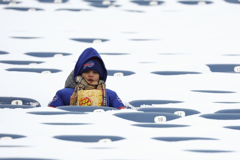
BUFFALO, N.Y. (AP) — Black Friday was giving way to a white weekend in parts of New York state, with the first big snow of the season threatening to bury towns along lakes Erie and Ontario during a hectic holiday travel and shopping weekend.
As flakes began flying Friday, forecasters warned 4 to 6 feet (1.2 to 1.8 meters) of blowing and drifting snow could fall in Watertown and other areas east of Lake Ontario through Monday.
After an unusually mild fall, as much as 2 to 3 feet (0.6 to 0.9 meters) of snow were possible along Lake Erie and south of Buffalo from lake-effect bands notorious for pummeling the region with snowfall rates of 2 to 4 inches (5 to 10 centimeters) per hour. Lake-effect snow happens when warm moist air rising from a body of water mixes with cold dry air overhead.
“The lake is 50 degrees (10 degrees Celsius). We’re about six degrees above where we should be this time of year, that’s why we’re seeing these heavy lake-effect events,” Erie County Public Works Commissioner William Geary said. “The outlook for the next two weeks into December, we’ll probably see some more.”
Gov. Kathy Hochul declared a for the targeted counties, allowing state agencies to mobilize resources. Rapidly deteriorating conditions Friday caused closures along Interstate 90, and tandem and commercial vehicles were banned from Interstate 86 in western New York and much of state Route 219 beginning Friday afternoon.
“There’s a considerable number of vehicles going off the road on the 219 currently,” Gregory Butcher, Erie County's deputy director for preparedness and homeland security, said at an afternoon briefing. He said ATVs and snowmobiles were being placed around the county to help first responders if necessary.
The Buffalo Bills called for volunteers to potentially shovel snow at Highmark Stadium, where over 2 feet (0.6 meters) of snow was possible before Sunday night's game against the San Francisco 49ers. Last year, a major lake-effect storm forced the NFL to playoff home game against Pittsburgh from Sunday to Monday.
“It’s going to be slow going, there’s no doubt about that,” Erie County Executive Mark Poloncarz said, adding the heaviest snow is expected to be over by kickoff.
The team, meanwhile, was preparing to play in any conditions.
“We’re trying to stay on top of it,” coach Sean McDermott said on Friday.
“You guys know things change around here quickly with the weather coming off the lake and everything. So we do the best we can,” he added.
The Bills are 9-2, their best start since 1992, and with a win Sunday, they would clinch their fifth straight AFC East title.
Lake-effect snow also covered parts of Michigan’s Upper Peninsula in a system that is expected to last through the weekend.
The area was blanketed in snow by Friday afternoon, with some places already measuring more than a foot (0.3 meters) of snow.
“We’ve got this westerly, northwesterly flow regime and this chilly air mass over the U.P.,” Chapman said. “So it’s a pretty good setup for this long duration lake-effect snowfall event.”
Heavy lake-effect snow in parts of northern Michigan was expected to continue into the weekend, according to the National Weather Service in Gaylord. Some areas of the Upper Peninsula could see up to 3 feet (0.9 meters) of snow Sunday night through to Monday, National Weather Service meteorologist Lily Chapman said.
Gusty winds, especially near the Great Lakes, has impacted visibility, and Chapman urged caution on the roads.
Joe DeLizio, a meteorologist for the National Weather Service in Gaylord, said that visibility on roads was low but that he hadn’t been made aware of any major accidents so far.
“Haven’t heard too much as far as problems, but obviously travel is pretty difficult,” DeLizio said.
___
AP Sports Writer John Wawrow contributed from Orchard Park, N.Y. Isabella Volmert contributed from Lansing, Michigan and and Joey Cappelletti from Sawyer, Michigan.
Carolyn Thompson, The Associated Press


