VANCOUVER — A study has found nearly half of the landslides, debris flows and washouts that occurred during British Columbia's atmospheric river disaster in November 2021 originated in areas that had been logged or burned by wildfire.
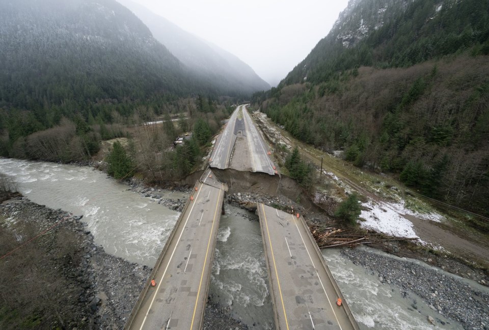
Severe rains triggered a landslide that killed five people on a stretch of Highway 99 east of Pemberton, while large swaths of roads and bridges were washed away cutting off coastal B.C. from the rest of the country.
Another 18,000 people were forced to evacuate their homes in southwestern B.C. as the series of drenching storms parked over the area for days, flooding farms and homes in the Fraser Valley.
The study, published in the peer-reviewed journal Earth Surface Processes and Landforms, covered about 70,000 square kilometres in the region, examining 1,360 debris flows, landslides and bank erosion triggered by the storm.
It found 17 per cent of those hazards originated within burned areas, while 14 per cent occurred at or below roads used by resource industries and an additional 15 per cent stemmed from logging cut blocks, for a total of 46 per cent.
Representatives of B.C.'s Forest Ministry and Transportation Ministry did not immediately respond to a request for comment on the study's findings.
The study says the province has improved logging practices over the last several decades, but "the approximately 400 resource road and cutblock-related geohazards triggered by the November 2021 (storm) show that these issues persist."
The paper says about 4,000 square kilometres of forest in the study area had been logged since 1990, with 3,600 square kilometres logged between 1900 and 1990.
It was published in January and written by Carie-Ann Hancock, a professional geoscientist with the consulting firm BGC Engineering.
The study also looked at more than 35,000 kilometres of forest service roads.
"Nearly half of the resource-road failures were from unmapped and presumably unmaintained resource roads," the paper says. "If these geohazards are to be effectively managed to reduce downstream impacts, significant effort would be required to map their locations and assess their current stability."
More than 1,600 wildfires had also scorched 8,700 square kilometres of land in 2021, making it B.C.'s third-worse season on record at the time, the paper says.
That number has since been eclipsed by the 2023 wildfire season, which saw more than 28,000 square kilometres of land burned in the province. A further 10,800 square kilometres burned last year.
The paper cites research showing atmospheric rivers are becoming more frequent and severe with climate change, which is also fuelling increasingly intense wildfires.
It says these trends "will likely lead to an increase in geohazards" in B.C.
This report by The Canadian Press was first published March 21, 2025.
Brenna Owen, The Canadian Press


