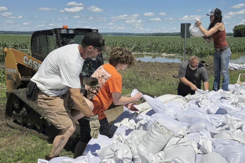
ST. LOUIS (AP) — Hundreds of Iowa residents have needed rescue from that has swamped parts of the state, covering buildings up to their rooftops, shutting down major roads, and disrupting basic services like electricity and drinking water.
Iowa Gov. Kim Reynolds said water in some areas rose above records from 1993, a flood many in the Midwest remember as the worst of their lives. The floods have hit parts of Iowa, South Dakota, Nebraska and Minnesota.
The water was so powerful that it pulled down a train bridge connecting North Sioux City, South Dakota, with Sioux City, Iowa. On the Blue Earth River in Minnesota, water forced its way around the Rapidan Dam and local officials warned of its possible failure.
The water is expected to be at its highest early this week — in some places it has already passed — and then the crest of the river will move south, eventually into the Missouri and Mississippi rivers.
“Businesses are shuttered, main streets have been impacted. Hospitals, nursing homes and other care facilities were evacuated,” Reynolds said at a news conference over the weekend, calling the expected damage “staggering.”
It's conditions worse.
A look at why waters are so high in the Midwest:
What is causing the bad flooding?
Torrential rains. The hardest hit areas were south of Sioux Falls, South Dakota. The city’s airport received more than 7 inches (17.8 centimeters). More than 11 inches (28 centimeters) fell in Rock Rapids, Iowa, a roughly 45-minute drive to the east.
“It has been just round after round through the month. And then recently, we've had a few big rounds," said Joseph Bauers, a meteorologist with AccuWeather.
Hot air in the Northeast has directed the path of storms through the Midwest, according to Shel Winkley, a weather and climate expert with Climate Central, a nonprofit focused on climate science.
“With that big high-pressure system over the East, that kind of helps steer these and slow these systems down specifically to where we've seen the flooding over the past few days,” he said.
And the most recent rounds of heavy rain have fallen on wet ground. When soil is wet, it can't absorb as much new moisture, so more of the rain runs into rivers and streams.
Flooding is a big change for a part of the country that has endured drought in recent years. Rain started to hit the region in late April and early May, according to National Weather Service hydrologist Jeff Zogg.
Then the really heavy storms came Friday and Saturday.
“There were some cases where rainfall was falling at a rate of over 1 inch in 15 minutes, for example,” Zogg said. “And that's because there's just so much moisture in the atmosphere that there is a lot of moisture for the thunderstorms to wring out.”
The amount of rain was incredible: Across five states, roughly 16 trillion gallons of water fell since last Monday, according to Ryan Maue, a private meteorologist and former chief scientist at the U.S. National Oceanic and Atmospheric Administration.
What is a crest and why do they matter?
A crest is the highest level a river reaches before receding, and they are tracked closely by forecasters. It's essential to know when a crest is expected to hit, how bad it will be and how fast it is traveling down river.
Because recent rains dumped extraordinary amounts of water on the region, rivers rose quickly, and crests are expected soon or have already occurred in some places.
Sioux City Fire Marshal Mark Aesoph told reporters that the Big Sioux River stabilized Monday morning at around 45 feet, over 7 feet higher than the previous record.
“It’s just been difficult to predict what’s going to happen when levels are this high when we have no history with it,” he said.
South Dakota Gov. Kristi Noem said other rivers, the James and Vermillion, are expected to crest Wednesday. The flooding is “more spread out” than expected, which is helping lessen flooding in some inhabited areas. It will “bump up” Missouri River levels, but not as much as anticipated, she said at a news conference Monday.
“The later and the lower crest levels gave us some time that we need to upgrade some levees that we needed to get done,” Noem said.
While the heaviest rain has been concentrated in northwestern Iowa, parts of northeastern Iowa will see up to an inch on Monday, said Zogg. The rainfall across northern Iowa will take “several days” to make its way through the state. He said the location of the rain was particularly bad for Iowa because it has to drain through the state's entire river system before exiting.
Since all that water eventually drains into the Missouri and Mississippi rivers, Zogg said, flooding is expected in those big rivers, as well.
And there is the possibility for more rain later this week.
“When it comes to the rainfall and river response, location and timing and the amount” will determine how the river responds and whether floods will get worse, he said.
Is this related to climate change?
In the Midwest, flooding isn’t new. Nor is heavy rain in June. And linking any particular big rainstorm to climate change is difficult, Winkley said.
But, as greenhouse gases warm the planet, the hotter atmosphere can hold more water. That means big rainstorms can pour down even more water, overwhelming sewer systems and flooding downtowns. , he said.
“The extremes are becoming more extreme,” said Winkley.
___
Associated Press reporters Hannah Fingerhut in Des Moines, Iowa, and Margery A. Beck in Omaha, Nebraska, contributed to this report.
___
The Associated Press receives support from the Walton Family Foundation for coverage of water and environmental policy. The AP is solely responsible for all content. For all of AP’s environmental coverage, visit
Michael Phillis, The Associated Press


