What is Squamish's elevation compared with other communities in our region?
This is a question The ┬ķČ╣╔ń╣·▓· put to local , emeritus scientist at the .
Elevation seems like a simple idea that we all understandŌĆöhow high a community isŌĆöbut what is topographic elevation, exactly?
"Topographic elevation refers to the height of land features or points on the Earth's surface relative to a reference baseline. The most common of these reference baselines is mean sea level (MSL)," explained Journeay, in an email exchange with The ┬ķČ╣╔ń╣·▓·.
"Elevation helps describe the shape of topographic landforms and how they have changed with time."
Journeay said factors that have influenced the elevation of land features relative to mean sea level in the Sea to Sky region include the formation of the Cordilleran ice sheet, deglaciation and isostatic rebound of the EarthŌĆÖs surface, tectonic uplift and related mountain-building, as well as climate change and related erosion processes.
OK, let's break that information down into chunks so it is easier to understand.
Cordilleran ice sheet: The Cordilleran ice sheet covered most of Canada west of the Prairies, between 20,000 and 18,000 years ago, according to a Government of Canada. "It attained a thickness of about two kilometres, and it briefly fused with the Laurentide ice sheet in the east. The retreat of the ice sheets was rapid, geologically speaking, taking only about 4,000 years."
Isostatic rebound: The "isostatic rebound of the EarthŌĆÖs surface," means "the process by which the Earth's crust rises when the weight from large ice masses, such as glaciers, is removed," reads , an educational app.
Tectonic uplift: "Tectonic uplift is the geological process where Earth's crust is elevated due to tectonic forces, often resulting from plate movements or volcanic activity," according to the app.
So what has all this meant for ┬ķČ╣╔ń╣·▓·and the Sea to Sky?
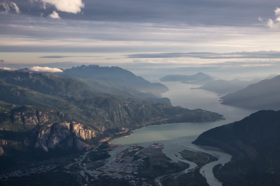
Journeay notes ├ütlŌĆÖka7tsem/Howe Sound was carved by glaciers of the Cordilleran ice sheet over 18,000 years ago.
"The weight of the ice sheet depressed the EarthŌĆÖs surface as much as 45 metres below its current elevation," Journeay explained.
As the ice sheet and valley glaciers meltedŌĆöbetween 14,000 and 11,000 years agoŌĆömarine waters extended Howe Sound up as far north as the Elaho Valley.
"Uplift of the land surface caused by isostatic rebound resulted in a relative drop in sea level to what we see today," he said.
It is important to note that elevation is dynamicŌĆöalways changingŌĆöespecially in coastal locations like Howe Sound.
"Ongoing tectonic uplift, mountain building and erosional processes caused by climate change have resulted in relative fluctuations in sea level and corresponding heights of land over time. Collectively, these processes contribute to both current and expected future coastal flooding hazards for many communities in our region," Journeay said.
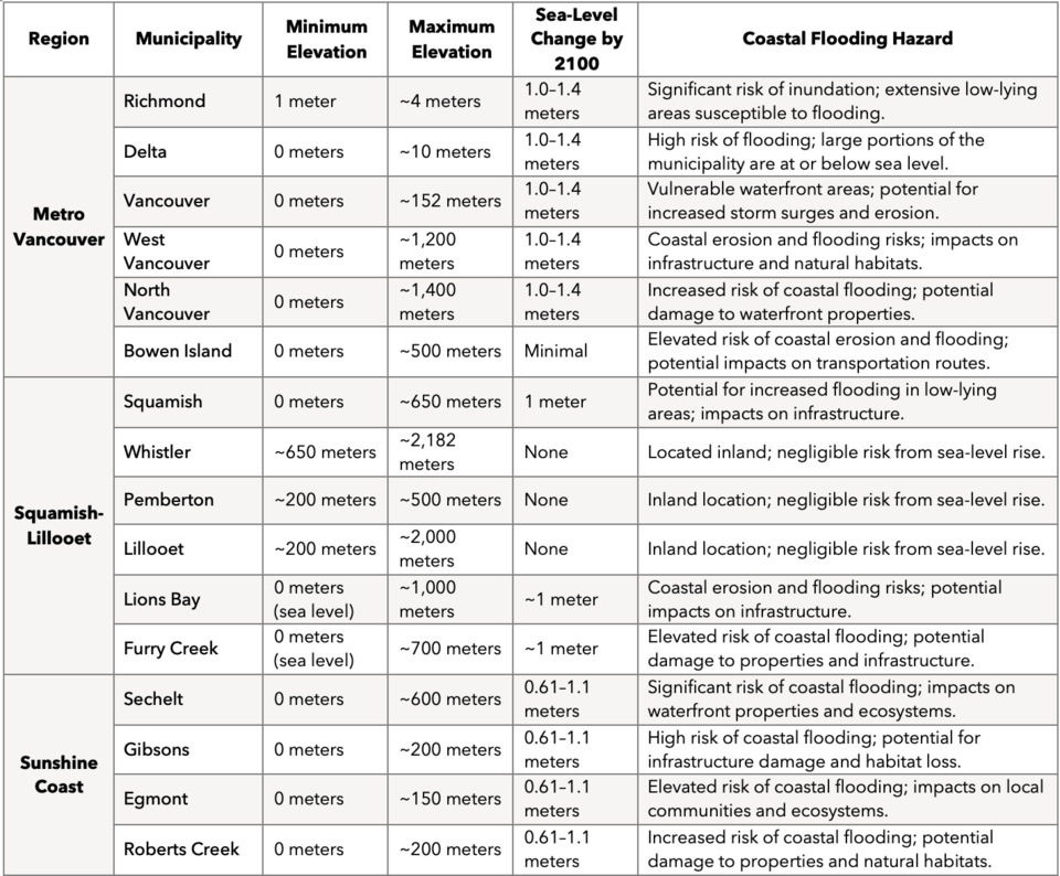
Here's a table supplied by Journeay that compares elevation, projected sea-level changes, and related coastal flooding hazards for communities in our region:


